Thursday 28 October 2010

Waitomo Caves and Wellington


On the way to Wellington, we stopped at the Waitomo glow worm caves to take a walk through. The caves are over 30 million years old, the glow worms are actually larvae, they live for about 10 months by catching insects with strings of mucus they make, which hang down quite prettily, they then hatch into flies which only live for 5weeks. The larvae glow in the dark and make pretty patterns on the wall. We also stopped at Tongariro National Park on the way through to view the snow capped mountains, so beautiful.
Wellington is the captial city of New Zealand, but it is really small, it only takes about an hour to walk from one end to the other, so was really easy to get around. I really liked it, much nicer than Auckland. We visited the Te Papa museum, New Zealands National museum, it was really good, set over 6 floors and telling the history of New Zealand's history, culture, people, land and art. We took a tour of Parliament House, the buildings and the really ugly beehive which is actually the executive wing, so called becuase of the shape. Afterwards we took the cable car at Kelburn, one of New Zealand's oldest and most popular tourist attraction, to the top of the Botanic Gardens, visited the Cable car museum, and then walked back downhill through the gardens,which were really lovely. The following day we hiked up Mount Victoria for 360 degree views of the city, it was a really clear sunny day, so well worth the steep climb. We tramped back down along the winding road with houses tucked away on the steep hillside, what a great (and expensive!) place to live.

Sunday 24 October 2010

Rotorua and Taupo


From Auckland, I started the journey south, first stopping at Mount Eden, an extinct volcano in Auckland, for panoramic views of the city and harbour. Then through the Hauraki plains to Thames, through Paeora, where New Zealands most famous fizzy drink, L & P, was first made, which was really refreshing. Then on to the Shires rest for lunch, gateway to the Hobbiton movie set, surrounded by lots of rolling green hills and sheep. When we reached Rotorua, the smell of rotton eggs hits you, this is because of the dense sulphur deposits in the area. In the evening I went to Tamaki Maori Hangi and Concert evening in the Tawa forest. In the village we learnt about Maori traditions and culture, and saw the Hangi, where they traditionally cook their meals, a hole in the ground, with lots of rocks in the bottom, the food is then covered with earth and left to cook for a few hours. The Maroi's danced and sang for us, and performed the Haka, then we sat down to enjoy our hangi meal. There was chicken, lamb, vegetables, stuffing and gravy, and in true backpacker style I ate like it was my last ever meal. There was even steamed pudding and custard, and pavlova so I had to have 3 helpings, since I have not had a dessert for 4 months!
The following day I walked round the Government Gardens in Rotorua, which were created in the 1890's, originally a scrubland geothermal area, turned into Edwardian Gardens which were really lovely. I walked along the shore of Lake Rotorua, which was milky white due to the particles of sulphur suspended in the water. It was amazing to see the amount of gas rising into the air, and hear the bubbling noises and smell the sulphur! Afterwards I went to Kuirau Park, another thermal area in Rotorua.
In the afternoon I went white water rafting on the Kaitaki River, grade 5 rapids! It was so good, we went over a gentle 2m and 1.5m waterfall easily, then the big one, 7 metres! It was so exciting, I was at the front of the raft and as we tipped over the edge our guide yelled 'down' and we all dived for the bottom of the raft. The nose dipped into the plunge pool at the bottom of the falls and then we bobbed up again, not one of us had fallen out. Awesome!
On the way to Taupo, we stopped at Lady Knox Geyser which is a natural geiser that erupts every day at 10.15am, which I thought was very strange that nature could be so precise, until the guide explained that he put something like soap powder in the geiser to create a reaction. The water reached about 10m high when the geiser erupted! It was then on to Huka Falls which has the greatest volume of water falling over it in New Zealand. Our overnight stop is in Taupo which is a small holiday village, next to the largest lake in New Zealand,which you could fit Singapore in. A really pretty place.

Sunday 17 October 2010

Auckland to the Bay of Islands, New Zealand


I flew from Brisbane to Auckland, New Zealand, which was a 3 hour flight. On first appearance New Zealand has a very similar feel to Australia, same urban landscape, etc, but with more English weather. One day it was really hot, next day pouring with rain! I stayed in downtown Auckland city so it was really easy to walk everywhere. I visited 'The Domain' where the War memorial museum is located. It's a really pretty, huge open area, with indoor Winter gardens which were beautiful. The following day I took a ferry to Rangitoto Island which is a volcanic island that erupted from the sea about 600 years ago. It was raining quite hard by now, but I still decided to hike to the top hoping the rain would stop. It didn't! I got soaked walking for about 40 minutes to the top and instead of spectacular views of the crater, and the island, all I could see was a fine mist, so disappointing! I could also visit other islands with my ticket but the rain didn't let off all day, so I caught the ferry to Devonport, a 15 minute trip from Auckland, which is a really picturesque town, with lots of cafes, antique and book shops, and very pretty colourful houses. It was nice but not so enjoyable to wander around in the rain.
I took a bus from Auckland north to the Bay of Islands and stayed in Paihia. Paihia is a very pretty beach town, from which you can take a day trip to Cape Reinga, the most northerly point of New Zealand. We stopped at Puketi karui forest and did the Manginagina scenic walk to view the native flora and fauna. Next on to Cape Reinga, where the Tasman sea meets the Pacific ocean, and you could see the waves crashing together where they met. There is a quaint light house right on the headland, which you could walk to. The cape is a spiritual place for Maori's who believe it is the departing place of the Maori spirit. After lunch at the beach we headed to Ninety Mile beach via Te Paki quicksand stream, if the bus stopped we would be sunk! We stopped off on the way to go sandboarding, which was great fun. We climbed to the top of a very steep sands dune, laid on our boogie boards and then went sliding all the way down. We drove along some of Ninety Mile beach in the bus which was specially built for driving on sand. On the way back to Paihia we stopped at Mangonui, a fishing village that apparently has the best fish and chips in New Zealand! The following day, we headed to the Waitangi Treaty Grounds where the treaty was signed between the British government and the Maori's, however as there were 2 versions, one English and one Maori, there were differing interpretations and the obligations the treaty placed on each side has been in contention ever since. We had hired bikes from the hostel so we also went to Haruru falls, which we thought was a 5km walk, so we locked our bikes to the fence and started walking, not realising that was only one way. They were good though. When we got back to our bikes, the combination lock had been broken, so that the numbers weren't visible and we had to call our hostel manager for him to come and cut the chain with bolt cutters. He thought it would probably have been some local Maori boys. That's the only attempt I am aware of on all my travels to steal from me, so I think I am doing well so far.

Tuesday 12 October 2010

The Great Ocean Road


From Adelaide I headed to Melbourne along The Great Ocean Road. We drove for about 8 hours to reach The Grampians National Park, where we did the Hollow Mountain hike, a 1.2km hike which was more of a rock climb than a hike. It was so steep but the view from the top was fantastic. Afterwards we went to Mackenzie Falls, named after the first prime minister of Australia. About 200 steps led down to the falls which was fun climbing back up after all the hiking I had done over the last 6 days, my legs were aching! The following day we headed for another hike in the Grampians, this time called 'The Pinnacle'. As you can guess it was another steep hill and more amazing views. Our first stop on the Great Ocean Road was 'The Bay of Islands', which was really beautiful, then the 'Bay of Martyrs, London Bridge (although part of it had fell down!), and then the Gibson steps to viw one of the twelve apostles. After dinner we headed back to 'The Twelve Apostles'- although there are only 8, as two of them fell into the sea twenty years ago and there weren't 12 in the first place! We watched the sunset over the apostles which was beautiful. The following day we took a treetop canopy walk at Otway fly in the rainforest. The drive along the great ocean road is gorgeous, the majority of the road is right by the ocean and quite twisty, it winds round the mountains, unlike most of the roads in Australia which are very straight. We stopped for lunch and koala spotting which we did see a couple high up in the trees. We then went to Bells beach for a spot of sunbathing, before making our last stop at Torquay, the home of surfing brand, Ripcurl. We reached Melbourne about 6pm and although we were all tired, decided to go to 'Neighbours night' at a pub in St Kilda, it had to be done! It was a fun night, there was a quiz and then Dr Karl's band played, and there was even an appearance from Paul Robinson. I had my photos taken with Karl, Stingray and some guy who I had no idea, but i think it was Paul Robinson's son. I haven't watched Neighbours for a very long time, but the place was packed with Brits, so it must still be popular!?

Friday 8 October 2010

The Flinders Ranges


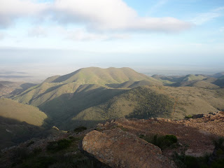
Quorn was a further 800km drive from Coober Pedy, taking about 8 hours. We stopped at a salt lake on the way, untouced by man as it is so remote. The salt is 3 times as salty as regualr salt. We stopped in Glendambo for a bbq lunch, population = 30. It used to be an army base, hence all the houses are very square. We reached Quorn late afternoon, it seemed strange being in a place with people and traffic again as we were no longer in the outback. The following day we visited Wilpena Pound in the Flinders Ranges National park which is a natural amphitheatre in a huge stone crater. We hiked up to the top which took about an hour and involved a lot of rock scrambling. The climb was worth it though as we had a fantastic 360 degree view of Wilpena Pound. We had a bbq lunch in the park, which is a great thing about Australia, bbqs are everywhere. Afterwards we visited the Yourambulla caves where there are Aboriginal paintings, which is the main way Aborgines communicated their culture, laws and teachings to the young. Thier language was a spoken language only until the 'white fella' came along and wanted to write it down. Last stop was Warren gorge where we tried to spot Rockwallabies, no luck though! The following day we got up at 5am to catch the sunrise at 'The Dutchman', another steep hill in the Flinders Ranges. It was so cold as we started hiking, it was a gradual climb taking about an hour to reach the top. The view was spectacular, the outback stretching as far as the eye could see. Lots of wild purple flowers, which was unusual but it has rained alot this year in Australia. We reached Adelaide late afternoon. I didn't like Adelaide much, it's just another city really.

Coober Pedy


Coober Pedy is a small opal mining town, about an 800km drive from Uluru. Coober Pedy is an Aboriginal word meaning 'whie fella in hole'. When the opal was discovered here, due to lack of timber and because it was so hot in summer and cold in winter the miners dug themselves homes underground as the temperature remained constant down there. We had a tour of the opal mine, and then a wander round Coober Pedy itself, it's deceiving because most of the houses are underground so it doesn't look like many people live there. Or hostel is built into the side of a rock, it is quite strange to be in a room with rock walls and no windows! Coober Pedy is the strangest town I have ever been in and I can understand why it's used in a lot of films. So surreal!

Uluru


The view from the plane as the plane touched down in Alice Springs was exactly how I imagined the outback to be, a flat barren landscape, mainly red with some greenery as well, however the amount of greenery is unusual, but it has rained alot this year, which is unusual. Alice Springs is a very small town with a couple of blocks of shops in the central business district and thats about all. An afternoon was long enough to see the whole of Alice Springs. Next morning, it was a 5.10am pick up from my hostel and then a 4 hour drive to Kings Canyon. Kings Canyon was formed about 480 million years ago, it's made up of two types of sandstone rock. We took a 3 hour hike, up, over and in the canyon. It was a really hot day 35 degrees but a dry heat. I was pestered by a lot of flies, the insect repellent didn't seem to have much effect. It wasn't a difficult hike but so hot. We visited the Garden of Eden, right in the middle which has a small lake. After clambering back down we headed back to the the campsite for a BBQ, camel sausages, kanagaroo steaks, both really good. We had another really early start the next day, 4.30am to catch the sunrise at Uluru by 6.26am. It was spectacular as the sun rose the rock turned different shades of red. We then walked round the base of the rock, which took about 2 hours. Up close the rock has large craters in it, and caverns. There is a climb to the top of Uluru but it is often closed due to high winds or rain or death! 77 people have died since 1985. The Aborgines who own the land do not like visitors to climb Uluru as it is a sacred site for them. There are parts of the rock where photography is forbidden as they are sacred spots to the Aborigines. After Uluru we headed to Kata Tjuta (The Olgas), part of the Uluru National Park. These were formed millions of years ago and are made of conglomorate rocks from the sea bed. It is strange to see the rocks sticking out of the landscape. They have been gradually eroded by the rain and wind into dome shapes.
We visited the Cultural centre in the afternoon, and then did the Mala walk round Uluru where Sheldon, our tour guide told us loads of interesting stories about Uluru and the Aborigines. We then caught the sunset at Uluru, where we had champange and nibbles....cool! We headed back to camp and I spent our last night sleeping in a swag under the stars. Beautiful!